SDG 7. Affordable and clean energy

We create wind atlases for the development of sustainable energies
Teresa Simões, Head Wind Energy
Laboratório Nacional de Energia e Geologia (LNEG), Lisbon, Portugal

The main challenges to the deployment of offshore windfarms are the lack of suitable and quality data to estimate offshore wind resources, investment costs – mainly installation, operation and maintenance, and sea conditions. The Copernicus Sentinel-1 and Sentinel-3 satellites can monitor the state of the sea with good spatial and temporal resolution and provide ocean wave spectra and ocean surface winds.

Interview

Photo: Diana Quintela

My name is Teresa Simões, I have a background in Meteorology and oceanography and a Phd in Energy and sustainable development. I have developed my work in the wind energy area since 1998, mainly in wind resource assessment and planning methodologies. I’ve been working at LNEG ever since, and since 2017 I am responsible for the wind energy area.

My mission is to study and develop projects in the area of renewable energies, mainly focusing on wind energy, to support public policies and to contribute to the training of technicians, young researchers and students.
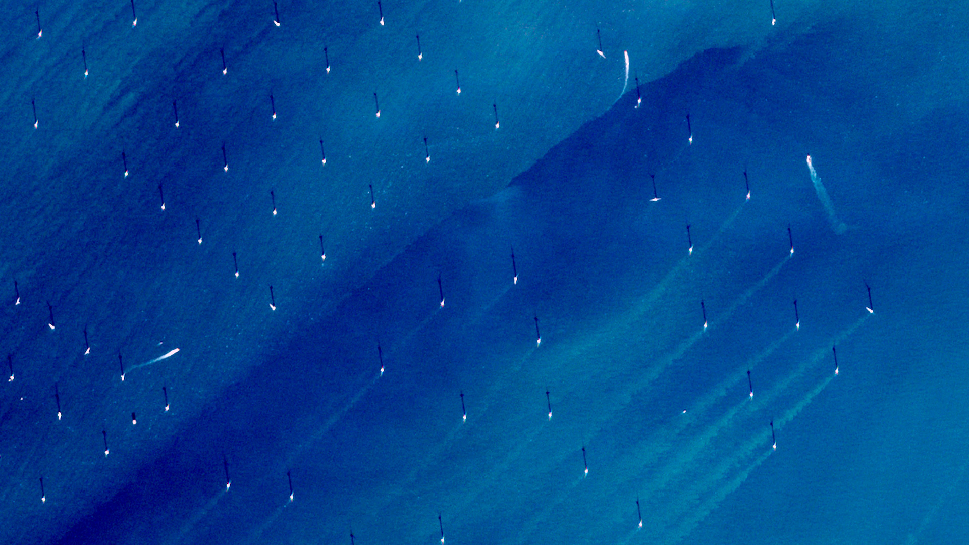
Open Data from the Copernicus satellites and Marine Service enables to inform impact studies and deployment plans. This image, acquired by one of the Copernicus Sentinel-2 satellites on 6 November 2020, shows the offshore windmills of the Norther wind farm in the North Sea off the Belgian coast.  The Copernicus Sentinel missions allow to monitor water quality and sediment transport in coastal areas.
Photo: European Union, Copernicus Sentinel-2 imagery

The main challenges to the deployment of offshore wind farms are the lack of suitable and quality data to estimate offshore wind resources, investment costs – mainly installation, operation and maintenance, and sea conditions. Going into more detail on resource assessment, let’s talk about wind data. The measurement campaigns at sea are still very expensive, especially when we need to characterize winds for deep offshore applications.

The role of satellite data in our research at LNEG is mainly as input data for modelling and validation, according to the specificities of the project that we are developing.

Satellite data became a valuable source of information and is very useful for different research applications such as climate change monitoring and renewable energy research. In our case it is mostly used in the latter – wind and wave energies research. The main advantage from using this data source is to provide high-resolution data for extended areas when the site of interest doesn’t have a network of observational data, for example, buoys, met masts, or other measurement equipment.

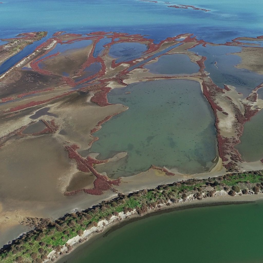
The Falkland Islands are featured in this radar image captured by the Copernicus Sentinel-1 mission, coordinated and managed by the European Commission. This multi-temporal image combines two radar acquisitions taken one month apart to show changes over time. The first image was captured on 29 December 2019, while the second was taken on 22 January 2020. Here, the main changes between acquisitions occurred in the open ocean, with the bright red colours showing wavy waters in December 2019. The Copernicus Sentinel-1 mission provides a continuous sampling of the seas, offering information on wind and waves. This is useful for understanding interactions between waves and currents and to improve efficiency for shipping and wave-energy applications.
Image: ESA/ contains modified Copernicus Sentinel data (2019-20), processed by ESA, CC BY-SA 3.0 IGO

As I mentioned before, experimental campaigns in situ are very expensive in respect of the equipment itself, its installation, operation and maintenance, which somehow justifies the absence of experimental offshore data at this date.

Nowadays, the Copernicus Sentinel-1 (Level-2) and Sentinel-3 can monitor the sea state with good spatial and temporal resolution and provide the ocean wave spectra and ocean surface winds.

This core information can be used as input data and boundary conditions or for validating results of models in respect, for example, of wave or offshore wind resource assessments. The offshore wind atlas provides the most accurate information about the wind energy potential for the region under study.
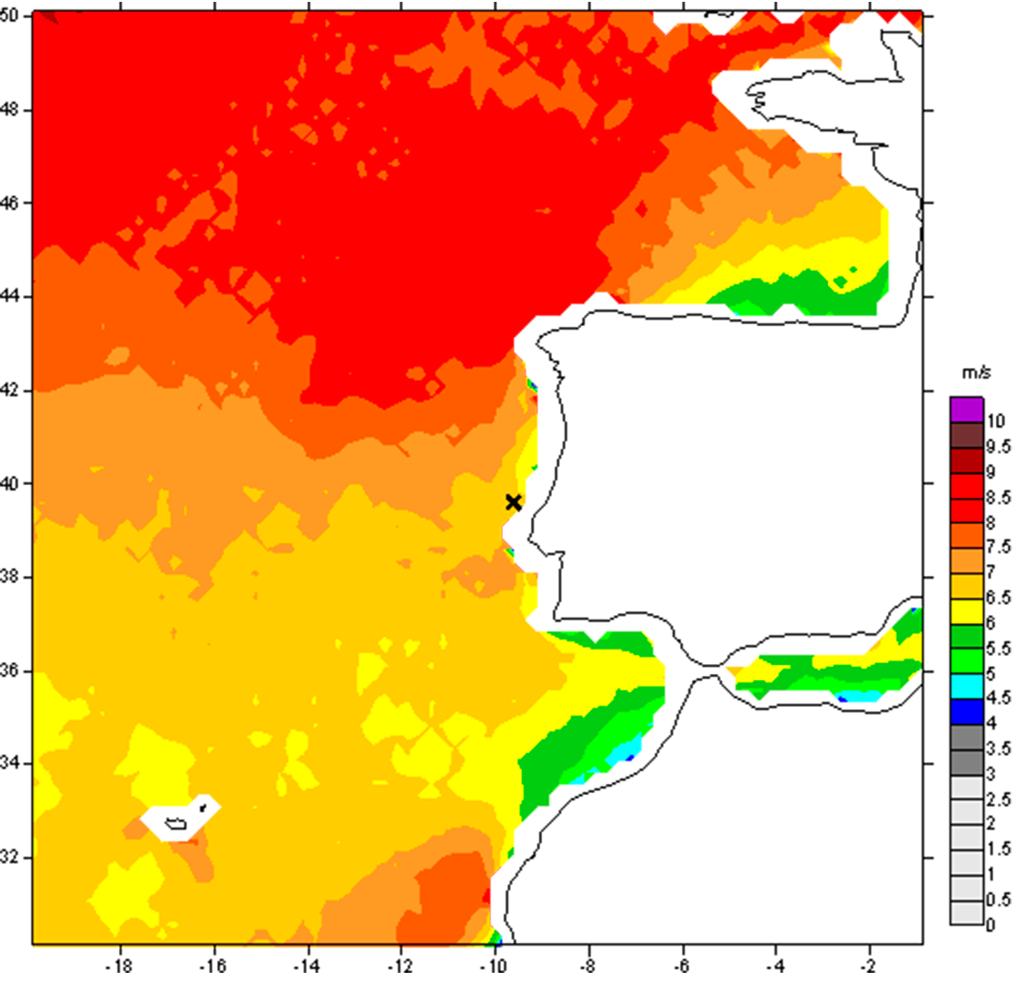
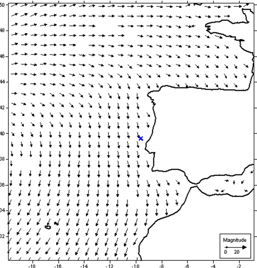
ASCAT-10year-mean-wind-speed  The Advanced Scatterometer (ASCAT) is one of the new-generation European instruments carried on the MetOp satellite by ESA/EUMETSAT.
Image: LNEG

It enables you to map the wind parameters, such as wind speed, Weibull parameters, and other meteorological variables at several heights and specific domains and areas. The wind atlas will also reflect the long-term behaviour of the wind resources, which is crucial for onshore and offshore wind farm deployment.

Satellite data can also be used to assess wave energy. Since early 1990, satellites have been equipped with specifically designed altimetry sensors that can deliver measurements of sea-state such as significant wave heights or wave periods that provide core information in assessing wave energy. Data from satellites may be used not only to assess the wave power available at a certain location but also to provide valuable information regarding the sea state characteristics that are important for the development of wave energy converters as well as for tuning those devices to the available sea state conditions. Nowadays Sentinel-3 can provide accurate estimates of the sea state and is therefore useful for assessing wave energy at a higher spatial resolution, especially near coastal areas.

Space has numerous exploitation options that go beyond astronomy and the search for extraterrestrial life. It is very important for science and for improvement to the environment and quality of life.

Space can bring opportunities to develop your skills, ideas, products and provide services for undertaking activities on Earth in so many areas, such as atmosphere, marine environment, land, climate, energy and security. So the potential is huge.

Allow yourselves to be inspired by Space and let your inspiration lead you to use the Space as a tool to make Earth a better place to live, namely with a higher quality environment.

Gallery
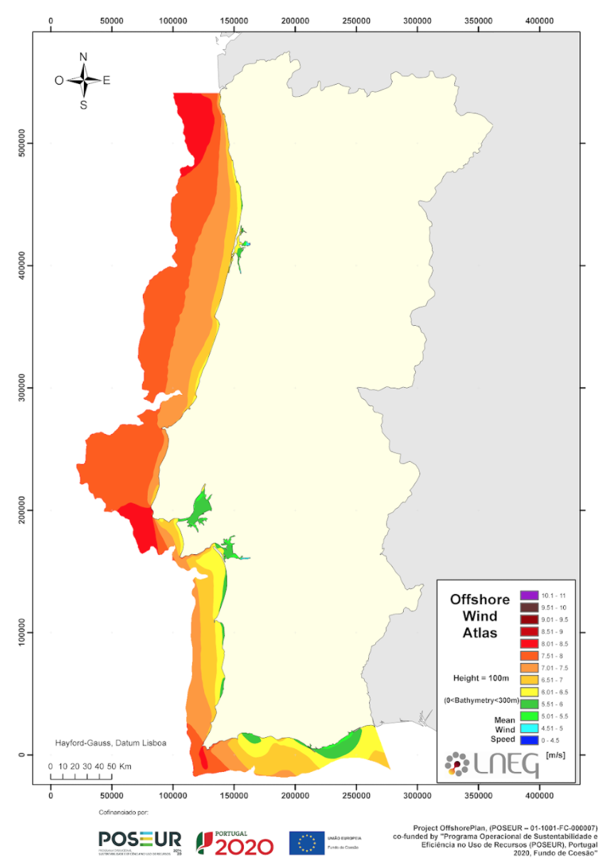
Portugal Offshore Wind Atlas
ASCAT-10year-mean-wind-direction. The Advanced Scatterometer (ASCAT) is one of the new-generation European instruments carried on the MetOp satellite jointly developed by ESA/EUMETSAT.
Open Data from the Copernicus satellites and Marine Service enables to inform impact studies and deployment plans. This image, acquired by one of the Copernicus Sentinel-2 satellites on 6 November 2020, shows the offshore windmills of the Norther wind farm in the North Sea off the Belgian coast. The Copernicus Sentinel missions allow to monitor water quality and sediment transport in coastal areas.
Open Data from the Copernicus satellites and Marine Service enables to inform impact studies and deployment plans. This image, acquired by one of the Copernicus Sentinel-2 satellites on 6 November 2020, shows the offshore windmills of the Norther wind farm in the North Sea off the Belgian coast. The Copernicus Sentinel missions allow to monitor water quality and sediment transport in coastal areas. Photo: European Union, Copernicus Sentinel-2 imagery
The Falkland Islands are featured in this radar image captured by the Copernicus Sentinel-1 mission. This multi-temporal image combines two radar acquisitions taken one month apart to show changes over time. The first image was captured on 29 December 2019, while the second was taken on 22 January 2020. Here, the main changes between acquisitions occurred in the open ocean, with the bright red colours showing wavy waters in December 2019. The Copernicus Sentinel-1 mission provides a continuous sampling of the seas, offering information on wind and waves. This is useful for understanding interactions between waves and currents and to improve efficiency for shipping and wave-energy applications.
The Falkland Islands are featured in this radar image captured by the Copernicus Sentinel-1 mission. This multi-temporal image combines two radar acquisitions taken one month apart to show changes over time. The first image was captured on 29 December 2019, while the second was taken on 22 January 2020. Here, the main changes between acquisitions occurred in the open ocean, with the bright red colours showing wavy waters in December 2019. The Copernicus Sentinel-1 mission provides a continuous sampling of the seas, offering information on wind and waves. This is useful for understanding interactions between waves and currents and to improve efficiency for shipping and wave-energy applications. Image: ESA/ contains modified Copernicus Sentinel data (2019-20), processed by ESA, CC BY-SA 3.0 IGO
Portugal Offshore Wind Atlas
Portugal Offshore Wind Atlas Image: LNEG
ASCAT-10year-mean-wind-direction. The Advanced Scatterometer (ASCAT) is one of the new-generation European instruments carried on the MetOp satellite jointly developed by ESA/EUMETSAT.
ASCAT-10year-mean-wind-direction. The Advanced Scatterometer (ASCAT) is one of the new-generation European instruments carried on the MetOp satellite jointly developed by ESA/EUMETSAT. Image: LNEG
ASCAT-10year-mean-wind-speed The Advanced Scatterometer (ASCAT) is one of the new-generation European instruments carried on the MetOp satellite by ESA/EUMETSAT.
ASCAT-10year-mean-wind-speed The Advanced Scatterometer (ASCAT) is one of the new-generation European instruments carried on the MetOp satellite by ESA/EUMETSAT. Image: LNEG
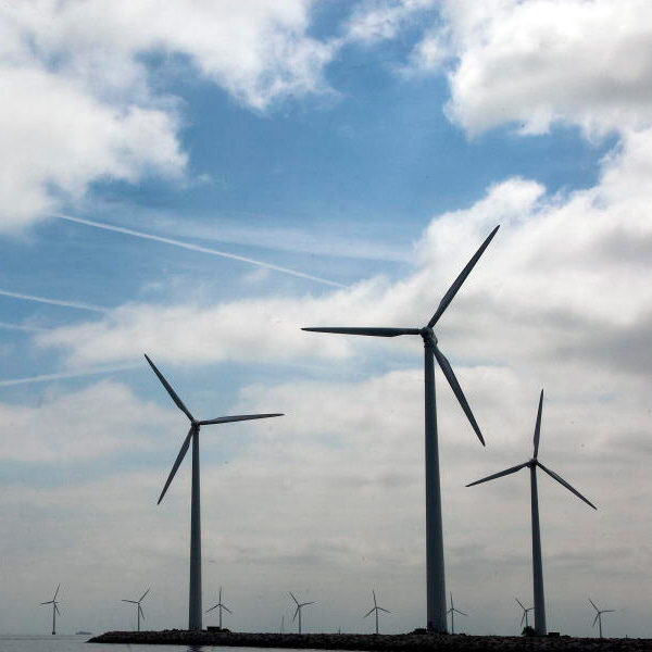
A view of the Middelgruden offshore wind farm. The wind farm was developed off the Danish coast and consists of 20 turbines.
A view of the Middelgruden offshore wind farm. The wind farm was developed off the Danish coast and consists of 20 turbines. Photo: Photo/Eskinder Debebe.
This story is under the SDGAffordable and clean energy

Ensure access to affordable, reliable, sustainable and modern energy

Check out more
Under the patronage of

With the support of